Quang Binh City

15/12/2022 05:11 PM
Geography
Located in North-Central Vietnam, Quang Binh Province is surrounded by Ha Tinh Province on the north, East Sea on the east, Laos on the west and Quang Tri Province on the south.

The provincial topography is narrow and sloping from the west to the east. The area is divided into specific geological zones: mountainous, hilly and midland, lowland, coastal sandy area. The seaside stretches 116km with large Gianh and Nhat Le ports.

Quang Binh belongs to the monsoon-tropical zone. The climate is divided into two seasons. Rainy season lasts from September to March next year. The annual average rainfall is 2, 000-2, 300mm. Heavy rains concentrate in September, October and November. Dry season lasts from April to August. Annual average degree is 24?C-26?C.

Tourism
Quang Binh is famous for many charming landscape of mountain and sea. The coast is dotted with blue water, yellow sand beaches that sparkle under forests of green willow trees.
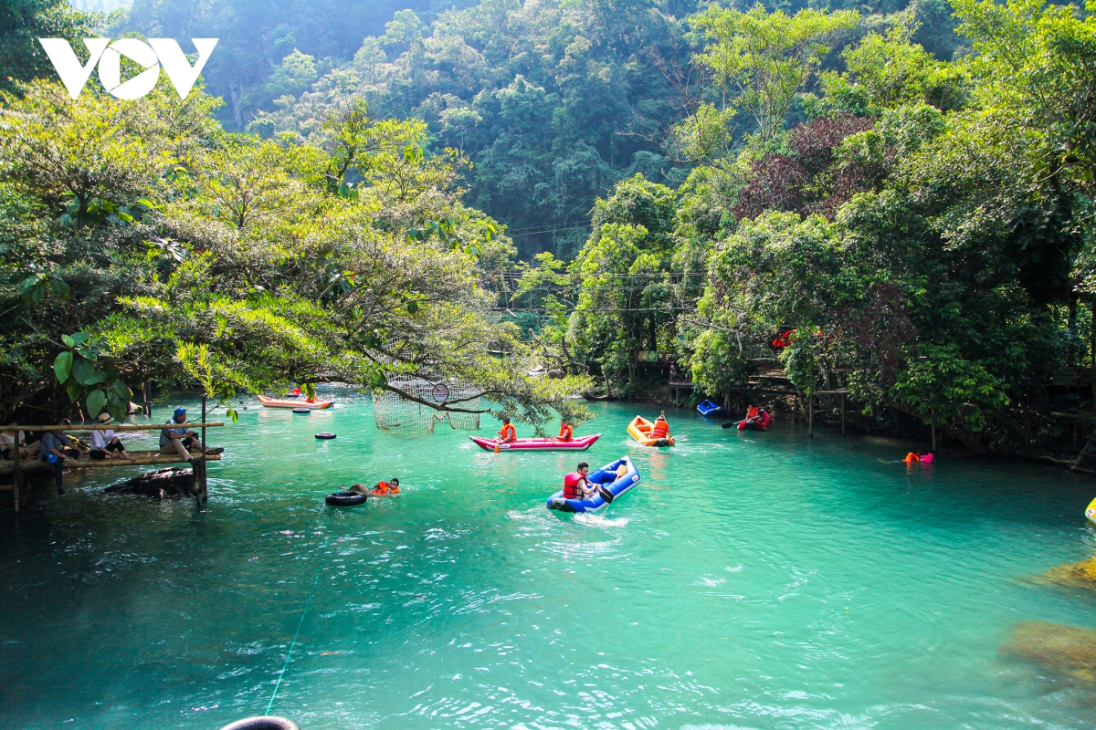
 

Every year, Quang Binh attracts many visitors coming to interesting landscapes such as Phong Nha, Tien Son caves, primitive forest in Phong Nha - Ke Bang reserve, Nhat Le, Da Nhay beaches, Bang Mineral Hot Spring, etc. Among of them, Phong Nha?- Ke Bang National Park has been recognized as the World Natural Heritage Site by UNESCO in 2003.
 

In addition of these, Quang Binh preserves objects from Bau Tro Remains, Hoa Binh and Dong Son culture as well as historical relics like Quang Binh Gate, Luy Thay, Rao Sen... Many places related two resistance wars name Cu Nam, Canh Duong, Cha Lo, Cong Troi, Xuan Son, Long Dai and Ho Chi Minh Trail.

Transprotation
Road, rail and shipping routes are fairly well developed. Dong Hoi City is 491km from Hanoi, 94km from Dong Ha, 166km from Hue, and 197km from Vinh. National Highway No.1A and North-South Express Train runs throw the province and stop at Dong Hoi City. Quang Binh has Cha Lo Border Gate in Minh Hoa District to Laos. 
Other post

Sapa

Hang Located 38km from Lao Cai City, Sapa is a mountainous district of Lao Cai Province. Sapa District is very well-known with Sapa Townlet, a beautiful and romantic resort...

Quang Nam

Quang Nam is located in the middle of Central Vietnam and is surrounded by Thua Thien-Hue, Quang Ngai, and Kon Tum provinces. The Truong Son Mountains, Laos, and the East Sea also border the province...

Nha Trang City

Considered Vietnam’s most famous seaside resort-town, Nha Trang attracts foreign tourists for not only its stunningly pristine beaches but also the urban atmosphere of a young tourist city...

Hue City

Hue city is one of places which have many cultural heritage. Up to now, there is no place like Hue remaining a lot of originally historical vestiges as in this ancient Capital City...

Ho Chi Minh City

In the core of the Mekong Delta, Ho Chi Minh City, formerly known as Saigon, is second the most important in Vietnam after Hanoi. It is not only a commercial center but also a scientific, technological, industrial and tourist center. The city is bathed by many rivers, arroyos and canals, the biggest river being the Saigon River...

Hanoi Capital

Hanoi is located in the Red River Delta, in the center of North Vietnam. It is encompassed by Thai Nguyen, Vinh Phuc provinces to the north, Hoa Binh and Ha Nam to the south, Bac Giang, Bac Ninh and Hung Yen provinces to the east, Hoa Binh and Phu Tho to the west...

Halong City

Halong City, formerly the Hon Gai Town, is the cultural, economic and political centre of Quang Ninh Province. It borders Cam Pha to the east, the Yen Hung District to the west, the Hoanh Bo District to the north and Halong Bay to the south with the coastline of 20km...

Hai Phong city

Hai Phong is a large city with an important seaport of Vietnam. Hai Phong is near Quang Ninh Province to the north, Hai Duong Province to the west, and Thai Binh Province to the south...

Dalat city

Dalat, capital of Lam Dong Province, is located approximately 308km northeast of Ho Chi Minh City. At an elevation of 1, 500m, Dalat bears the look of an Old French city. It was founded in 1897 when Doctor Alexandre Yersin recommended that the area be developed as a resort town...

Da Nang City

Danang City is located in middle of Central Vietnam, between Hanoi and Ho Chi Minh City, separated from Laos by the western Truong Son Mountains. It is surrounded by Thua Thien-Hue along the northern border and Quang Nam on the southern border. It is embraced by the East Sea with 150km of seacoast.

Can Tho city

Can Tho City is located in the center of the Mekong Delta. It is contiguous to 5 provinces: An Giang on the north, Dong Thap on the north-east, Hau Giang on the south, Kien Giang on the west, and Vinh Long on the east. Can Tho has a complex of rivers and canals such as Hau, and Can Tho rivers, Thot Not, O Mon canals. Among them, the Hau Riveris considered a benefactor of this region, since yearly floods deposit large quantities of alluvia to the rice fields. Thank to that Cantho becomes "the green lungs of the Mekong Delta".The climate is harmonized with few of storms. It is hot, humid all year. Rainy season lasts from May to November, and dry season lasts from December to April. The annual average temperature is 27oC.

Quick Question?

If you are interested in booking tours, cruises, services, other information with us, please enter your name, email and message.
Send

Tripavisor

FanPage

©2021 http://vietnamanztravel.vn/.